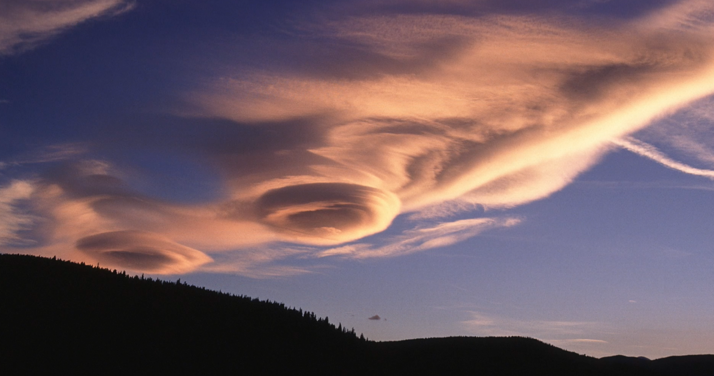
Lenticular, or lee wave, clouds form downwind from an obstacle in the path of a strong air current. In this case the obstacle is the Front Range of the Rocky Mountains, CO. Lenticular clouds can often be seen along the lee side of the range. The setting sun gives this lenticular cloud its yellow orange cast. Photo credit: Carlye Calvin. Thank you Open Sky!
Lenticular Clouds
by Yuxi Suo & Leah Salditch
Often mistaken for UFOs, lenticular clouds tend to capture people's imaginations. Not to be feared, these atmospheric phenomena are commonly misunderstood but can easily be explained with some simple atmospheric science. These unusual, lens-shaped clouds (hence the name len-ticular) often appear above mountains, and remain in place for extended periods of time. No, they are not harbingers of an alien invasion, instead they are the result of atmospheric processes interacting with the earth's uneven surface.
Orographic lifting (the prefix Oro- comes from the ancient Greek for ‘mountain and to raise oneself) is a phenomenon wherein flowing air encounters a topographic obstacle and is deflected upward and over it. Often these obstacles are mountains, but they can be large buildings or other man-made structures. Lenticular clouds can form just above the obstacle, or rise all the way to the top of the troposphere. The air that is deflected upward around obstacles experiences a process called adiabatic expansion/cooling.
Adiabatic processes are those in which the temperature of an air mass changes without heat being added or removed – a phenomenon responsible for many atmospheric processes. Recall that the molecules in gases are always in motion, and the rate of that motion determines the temperature. Now consider a parcel of air rising in the atmosphere. The parcel will experience a decrease in pressure as it rises, causing the molecules within the parcel to be less confined. This will cause a decrease in the speed of the molecules as they collide with each other less frequently because they have more room to move around. As a result of the decreased collisions and speed of the molecules, the temperature decreases without any heat actually being removed from the air parcel. The rising parcel of air thus cools, and the water vapor in it is now able to condense and form liquid cloud droplets. The opposite behavior also occurs: a sinking parcel of air will compress as pressure increases toward the Earth's surface. The compression will lead to an increase in temperature, which is called adiabatic compression/warming.
Figure 1: Wind moves from the 'wind-ward side' (left in the picture) toward the 'lee-ward side' or 'lee-side (right). When the wind encounters an obstacle, it is deflected upward, and sometimes forms mountain waves. Lenticular clouds can occur in the ridges of the mountain waves. (After Wallace and Hobbs, 2006).
Lenticular clouds take two primary forms: a single cloud, or a lee-wave train. Lee-wave trains are those with multiple isolated lenticular clouds occurring downstream from the obstacle and are often visible in satellite images (see the two clouds in top of Figure 1). There is only a narrow formation region that exists on the lee-side of the mountain because of the wind direction and orographic lifting (Grubišić & Billings, 2008). As Smith (1979) concluded, vertical propagation of wave energy is limited in the wave-like pattern. A sharp increase in crossmountain wind with height, or a pronounced mountain-top inversion, or a combination of these two factors can result in a low-level wave pattern that can extend significant horizontal distances from the generating terrain (Smith, 1979).
In the ridge of the wave train, adiabatic expansion/cooling leads to condensation of moisture in the air parcel, which forms clouds (Figure 1). As the air cools, it will tend to sink, and with adiabatic compression/warming droplets gradually evaporate in the trough of the wave train. This leads to the single lenticular clouds in the ridge of the wave train, which appear spaced out horizontally instead of being connected to one another (Figure 1). New droplets constantly form between the trough and the ridge, and old droplets evaporate on the other side, so the clouds remain in a fixed position even while the wind continues to move (Aguado and Burt, 2007).
This is how the processes of orographic lifting, adiabatic expansion, wave trains, and condensation intersect to form lenticular clouds. While they don't always combine to form dramatic lenticular clouds, these processes are involved in many other weather phenomenon that affect your daily life and help make Earth a habitable place for all of us.
References:
Aguado, E., & Burt, J. E. (2007). Understanding weather and climate. Upper Saddle River, N.J:
Pearson Prentice Hall. Grubišić, V., & Billings, B. J. (2008). Climatology of the Sierra Nevada Mountain-Wave Events.
Monthly Weather Review, 136(2), 757-768. doi:10.1175/2007mwr1902.1 Smith, R. B. (1979). The Influence of Mountains on the Atmosphere. Advances iGeophysics
Volume 21 Advances in Geophysics, 87-230. doi:10.1016/s0065-2687(08)60262-9 Wallace, J. M., & Hobbs, P. V. (2006). Atmospheric science: An introductory survey.
Amsterdam: Elsevier Academic Press.
See all our Science Explainers here
Back to SkyDayProject
Yuxi Suo & Leah Salditch created this while students in the Department of Earth and Planetary Sciences at Northwestern University


